
Thank you for supporting this site ❤️
Make a donation
Make a donation
Wijhe topographic map
Click on the map to display elevation.
Thank you for supporting this site ❤️
Make a donation
Make a donation
About this map
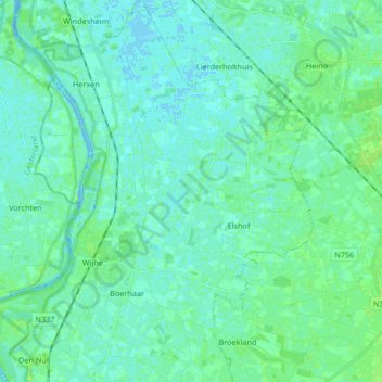
Name: Wijhe topographic map, elevation, terrain.
Location: Wijhe, Olst-Wijhe, Oberyssel, Niederlande (52.35211 6.10958 52.45354 6.23212)
Average elevation: 4 m
Minimum elevation: -6 m
Maximum elevation: 42 m
Thank you for supporting this site ❤️
Make a donation
Make a donation
Other topographic maps
Click on a map to view its topography, its elevation and its terrain.