
Thank you for supporting this site ❤️
Make a donation
Make a donation
Pacet topographic map
Click on the map to display elevation.
Thank you for supporting this site ❤️
Make a donation
Make a donation
About this map
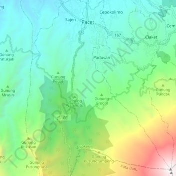
Name: Pacet topographic map, elevation, terrain.
Location: Pacet, Mojokerto, Java, Indonesia (-7.73563 112.52470 -7.65663 112.57487)
Average elevation: 1,166 m
Minimum elevation: 452 m
Maximum elevation: 3,143 m
Thank you for supporting this site ❤️
Make a donation
Make a donation
Other topographic maps
Click on a map to view its topography, its elevation and its terrain.