
Kazreti topographic map
Interactive map
Click on the map to display elevation.
About this map
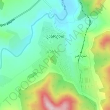
Name: Kazreti topographic map, elevation, terrain.
Location: Kazreti, Bolnisi Municipality, Lower Kartli, Georgia (41.37318 44.40113 41.38984 44.42267)
Average elevation: 727 m
Minimum elevation: 619 m
Maximum elevation: 959 m
There are two public schools, a library, and a small police station in Kazreti. Latitude 41.379963, longitude 44.410007, elevation 699 meters.
Other topographic maps
Click on a map to view its topography, its elevation and its terrain.
Kvemo Arkevani
Georgia > Lower Kartli > Bolnisi Municipality
Kvemo Arkevani, Bolnisi Municipality, Lower Kartli, Georgia
Average elevation: 393 m
Kazreti
Georgia > Lower Kartli > Bolnisi Municipality
Kazreti, Bolnisi Municipality, Lower Kartli, Georgia
Average elevation: 725 m