
Donk topographic map
Interactive map
Click on the map to display elevation.
About this map
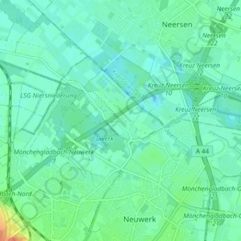
Name: Donk topographic map, elevation, terrain.
Average elevation: 39 m
Minimum elevation: 30 m
Maximum elevation: 69 m
Other topographic maps
Click on a map to view its topography, its elevation and its terrain.
Nord
Duitsland > Noordrijn-Westfalen > Mönchengladbach
Nord, Mönchengladbach, Noordrijn-Westfalen, Duitsland
Average elevation: 68 m
Rheydt
Duitsland > Noordrijn-Westfalen > Mönchengladbach
Rheydt, Süd, Mönchengladbach, Noordrijn-Westfalen, 41236, Duitsland
Average elevation: 62 m