
Thank you for supporting this site ❤️
Make a donation
Make a donation
Lugsangan Peak topographic map
Click on the map to display elevation.
Thank you for supporting this site ❤️
Make a donation
Make a donation
About this map
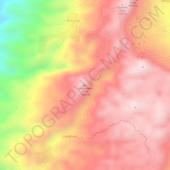
Name: Lugsangan Peak topographic map, elevation, terrain.
Location: Lugsangan Peak, Patong, Cebu, Central Visayas, Philippines (9.80726 123.43632 9.80736 123.43642)
Average elevation: 883 m
Minimum elevation: 564 m
Maximum elevation: 1,027 m
Thank you for supporting this site ❤️
Make a donation
Make a donation