
Thank you for supporting this site ❤️
Make a donation
Make a donation
Darvel topographic map
Click on the map to display elevation.
Thank you for supporting this site ❤️
Make a donation
Make a donation
About this map
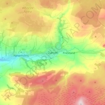
Name: Darvel topographic map, elevation, terrain.
Location: Darvel, East Ayrshire, Scotland, KA17 0AA, United Kingdom (55.56972 -4.32184 55.64972 -4.24184)
Average elevation: 214 m
Minimum elevation: 54 m
Maximum elevation: 385 m
Thank you for supporting this site ❤️
Make a donation
Make a donation
Other topographic maps
Click on a map to view its topography, its elevation and its terrain.
Thank you for supporting this site ❤️
Make a donation
Make a donation
Thank you for supporting this site ❤️
Make a donation
Make a donation