
Thank you for supporting this site ❤️
Make a donation
Make a donation
La Glace topographic map
Click on the map to display elevation.
Thank you for supporting this site ❤️
Make a donation
Make a donation
La Glace
La Glace is a hamlet in northern Alberta, Canada within the County of Grande Prairie No. 1. It is located along Highway 59 between Sexsmith and Valhalla Centre and has an elevation of 735 metres (2,411 ft).
Thank you for supporting this site ❤️
Make a donation
Make a donation
About this map
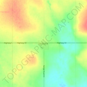
Name: La Glace topographic map, elevation, terrain.
Average elevation: 738 m
Minimum elevation: 713 m
Maximum elevation: 764 m
Thank you for supporting this site ❤️
Make a donation
Make a donation