
Thank you for supporting this site ❤️
Make a donation
Make a donation
Batu Pahat topographic map
Click on the map to display elevation.
Thank you for supporting this site ❤️
Make a donation
Make a donation
About this map
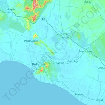
Name: Batu Pahat topographic map, elevation, terrain.
Location: Batu Pahat, Johor, Malaysia (1.62222 102.77417 2.20050 103.25405)
Average elevation: 19 m
Minimum elevation: -4 m
Maximum elevation: 558 m
Thank you for supporting this site ❤️
Make a donation
Make a donation
Other topographic maps
Click on a map to view its topography, its elevation and its terrain.