
Thank you for supporting this site ❤️
Make a donation
Make a donation
Kesternich topographic map
Click on the map to display elevation.
Thank you for supporting this site ❤️
Make a donation
Make a donation
Kesternich
Kesternich ligt in de Eifel op een hoogte van 531 meter. Het landschap sluit aan bij het Monschauer heggenlandschap.
Thank you for supporting this site ❤️
Make a donation
Make a donation
About this map
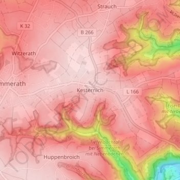
Name: Kesternich topographic map, elevation, terrain.
Average elevation: 509 m
Minimum elevation: 299 m
Maximum elevation: 562 m
Thank you for supporting this site ❤️
Make a donation
Make a donation