
Oberhaigen topographic map
Interactive map
Click on the map to display elevation.
About this map
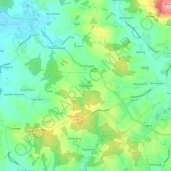
Name: Oberhaigen topographic map, elevation, terrain.
Location: Oberhaigen, Enzenkirchen, Bezirk Schärding, 4771, Österreich (48.36058 13.59788 48.40058 13.63788)
Average elevation: 386 m
Minimum elevation: 335 m
Maximum elevation: 493 m
Other topographic maps
Click on a map to view its topography, its elevation and its terrain.
Matzing
Österreich > Bezirk Schärding > Enzenkirchen
Matzing, Enzenkirchen, Bezirk Schärding, 4761, Österreich
Average elevation: 475 m