
Thank you for supporting this site ❤️
Make a donation
Make a donation
Thottumukkam topographic map
Click on the map to display elevation.
Thank you for supporting this site ❤️
Make a donation
Make a donation
About this map
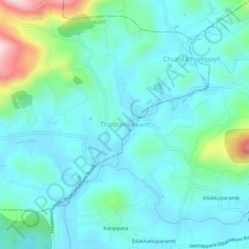
Name: Thottumukkam topographic map, elevation, terrain.
Location: Thottumukkam, Kozhikode, Kerala, India (11.26164 76.03907 11.30164 76.07907)
Average elevation: 85 m
Minimum elevation: 12 m
Maximum elevation: 403 m
Thank you for supporting this site ❤️
Make a donation
Make a donation
Other topographic maps
Click on a map to view its topography, its elevation and its terrain.