
Füllinsdorf topographic map
Interactive map
Click on the map to display elevation.
About this map
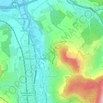
Name: Füllinsdorf topographic map, elevation, terrain.
Location: Füllinsdorf, Bezirk Liestal, Basel-Landschaft, 4414, Schweiz (47.49775 7.71820 47.52833 7.75049)
Average elevation: 358 m
Minimum elevation: 268 m
Maximum elevation: 574 m