
Sasseneire topographic map
Interactive map
Click on the map to display elevation.
About this map
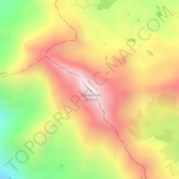
Name: Sasseneire topographic map, elevation, terrain.
Location: Sasseneire, Anniviers, Hérens, Valais, 3961, Suisse (46.13889 7.52465 46.13899 7.52475)
Average elevation: 2,756 m
Minimum elevation: 2,195 m
Maximum elevation: 3,223 m
Other topographic maps
Click on a map to view its topography, its elevation and its terrain.