
Farmington topographic map
Interactive map
Click on the map to display elevation.
About this map
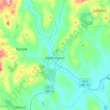
Name: Farmington topographic map, elevation, terrain.
Location: Farmington, Franklin County, Maine, United States of America (44.58886 -70.22429 44.76205 -70.05946)
Average elevation: 194 m
Minimum elevation: 93 m
Maximum elevation: 620 m