
Longridge topographic map
Click on the map to display elevation.
About this map
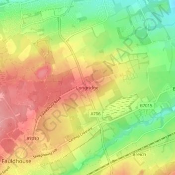
Name: Longridge topographic map, elevation, terrain.
Location: Longridge, West Lothian, Scotland, EH47 8NZ, United Kingdom (55.82436 -3.69827 55.86436 -3.65827)
Average elevation: 217 m
Minimum elevation: 167 m
Maximum elevation: 265 m
Other topographic maps
Click on a map to view its topography, its elevation and its terrain.
Linlithgow Palace and High Street Conservation Area
United Kingdom > Scotland > West Lothian > Linlithgow
Average elevation: 78 m