
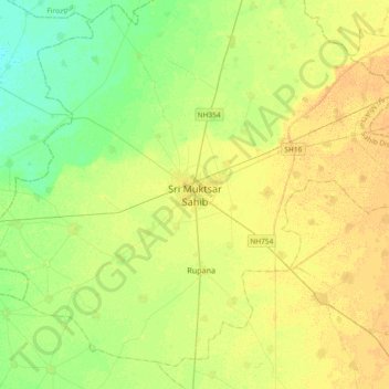
Sri Muktsar Sahib topographic map
Interactive map
Click on the map to display elevation.
About this map
Name: Sri Muktsar Sahib topographic map, elevation, terrain.
Average elevation: 197 m
Minimum elevation: 185 m
Maximum elevation: 207 m
The average land elevation of the city is 648.52 feet (197.67 metres) above sea level. Lithologically, Muktsar is a part of the vast Indo-Gangetic alluvial plain, composed of alternate bands of sands, silt and clay with pebbles. Sandy plains, sand dunes and topographic depressions are the common landforms.