
Lagdo topographic map
Interactive map
Click on the map to display elevation.
About this map
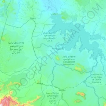
Name: Lagdo topographic map, elevation, terrain.
Location: Lagdo, Bénoué, Nord, Cameroun (8.35044 13.26764 9.16196 13.83822)
Average elevation: 310 m
Minimum elevation: 183 m
Maximum elevation: 1,918 m