
Thank you for supporting this site ❤️
Make a donation
Make a donation
North Wroughton topographic map
Click on the map to display elevation.
Thank you for supporting this site ❤️
Make a donation
Make a donation
About this map
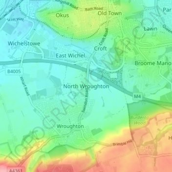
Name: North Wroughton topographic map, elevation, terrain.
Location: North Wroughton, Swindon, England, SN4 9AD, United Kingdom (51.51452 -1.80512 51.55452 -1.76512)
Average elevation: 126 m
Minimum elevation: 94 m
Maximum elevation: 206 m
Thank you for supporting this site ❤️
Make a donation
Make a donation
Other topographic maps
Click on a map to view its topography, its elevation and its terrain.
Thank you for supporting this site ❤️
Make a donation
Make a donation
Thank you for supporting this site ❤️
Make a donation
Make a donation
Thank you for supporting this site ❤️
Make a donation
Make a donation