
La Rosilla topographic map
Interactive map
Click on the map to display elevation.
About this map
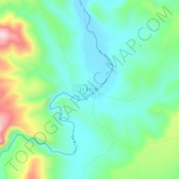
Name: La Rosilla topographic map, elevation, terrain.
Location: La Rosilla, Guanaceví, Durango, México (26.34801 -106.22006 26.38801 -106.18006)
Average elevation: 2,074 m
Minimum elevation: 1,977 m
Maximum elevation: 2,322 m
Other topographic maps
Click on a map to view its topography, its elevation and its terrain.