
Thank you for supporting this site ❤️
Make a donation
Make a donation
Bear Creek topographic map
Click on the map to display elevation.
Thank you for supporting this site ❤️
Make a donation
Make a donation
About this map
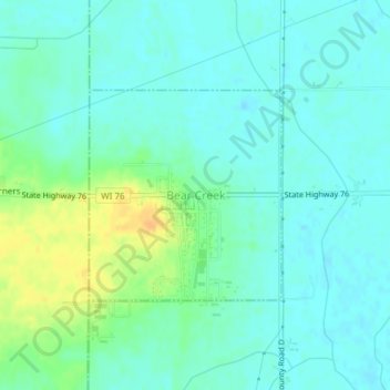
Name: Bear Creek topographic map, elevation, terrain.
Location: Bear Creek, Outagamie County, Wisconsin, United States (44.52403 -88.73689 44.53863 -88.71816)
Average elevation: 247 m
Minimum elevation: 238 m
Maximum elevation: 268 m
Thank you for supporting this site ❤️
Make a donation
Make a donation
Other topographic maps
Click on a map to view its topography, its elevation and its terrain.