
Chiracha topographic map
Interactive map
Click on the map to display elevation.
About this map
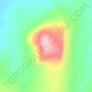
Name: Chiracha topographic map, elevation, terrain.
Location: Chiracha, Sidama, RNNPS, Éthiopie (6.62938 38.12489 6.62948 38.12499)
Average elevation: 1,458 m
Minimum elevation: 1,333 m
Maximum elevation: 1,660 m
Other topographic maps
Click on a map to view its topography, its elevation and its terrain.
Butajiri-Silti Field
Butajiri-Silti Field, Guraghe, RNNPS, Éthiopie
Average elevation: 2,092 m
Parc national de Mago
Parc national de Mago, South Omo, RNNPS, Éthiopie
Average elevation: 668 m
Nechisar National Park Hq
Éthiopie > RNNPS > አርባ ምንጭ / Arba Minch
Nechisar National Park Hq, አርባ ምንጭ / Arba Minch, Gamo Gofa, RNNPS, 40, Éthiopie
Average elevation: 1,216 m
Kembata Alaba Tembaro
Kembata Alaba Tembaro, RNNPS, Éthiopie
Average elevation: 1,913 m
Tosa Sucha
Éthiopie > RNNPS > አርባ ምንጭ / Arba Minch
Tosa Sucha, አርባ ምንጭ / Arba Minch, Gamo Gofa, RNNPS, Éthiopie
Average elevation: 1,376 m