
Seyne topographic map
Interactive map
Click on the map to display elevation.
About this map
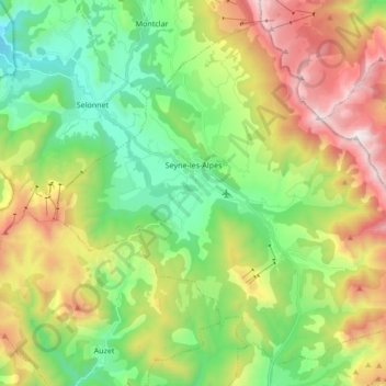
Name: Seyne topographic map, elevation, terrain.
Average elevation: 1,506 m
Minimum elevation: 947 m
Maximum elevation: 2,452 m
Seyne liegt etwa 42 Kilometer (Fahrtstrecke) nordöstlich von Digne-les-Bains bzw. etwa 45 Kilometer südöstlich von Gap in einem Hochtal der Seealpen in einer Höhe von etwa 1.260 m ü. d. M. Die italienische Grenze ist etwa 45 Kilometer (Luftlinie) in östlicher Richtung entfernt. Im Gemeindegebiet von Seyne entspringt der Fluss Bès.