
Sonneberg topographic map
Interactive map
Click on the map to display elevation.
About this map
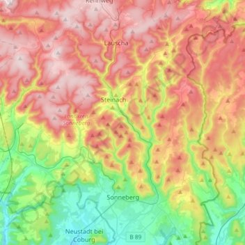
Name: Sonneberg topographic map, elevation, terrain.
Location: Sonneberg, Landkreis Sonneberg, Thüringen, 96515, Duitsland (50.32086 11.11405 50.50751 11.28479)
Average elevation: 586 m
Minimum elevation: 327 m
Maximum elevation: 866 m