
Stockhorn topographic map
Interactive map
Click on the map to display elevation.
About this map
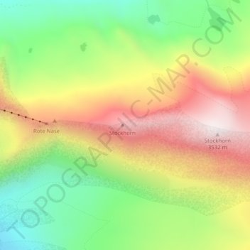
Name: Stockhorn topographic map, elevation, terrain.
Location: Stockhorn, Zermatt, Viège, Valais, 3920, Suisse (45.98659 7.82335 45.98669 7.82345)
Average elevation: 3,006 m
Minimum elevation: 2,583 m
Maximum elevation: 3,493 m
Other topographic maps
Click on a map to view its topography, its elevation and its terrain.
Pointe Dufour (Mont Rose)
Pointe Dufour (Mont Rose), Zermatt, Viège, Valais, 3920, Suisse
Average elevation: 4,033 m
Cabane du Mountet CAS
Cabane du Mountet CAS, Arbengrat, Chalbermatten, Zermatt, Viège, Valais, 3920, Suisse
Average elevation: 2,925 m
Pointe Dunant
Pointe Dunant, Zermatt, Viège, Valais, 3920, Suisse
Average elevation: 4,017 m
Pointe de Zinal
Pointe de Zinal, Zermatt, Viège, Valais, 3920, Suisse
Average elevation: 3,356 m