
Jupiter Island topographic map
Interactive map
Click on the map to display elevation.
About this map
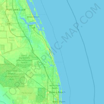
Name: Jupiter Island topographic map, elevation, terrain.
Location: Jupiter Island, Martin County, Florida, USA (26.71172 -80.42060 27.35172 -79.78060)
Average elevation: 3 m
Minimum elevation: -3 m
Maximum elevation: 27 m
Other topographic maps
Click on a map to view its topography, its elevation and its terrain.
Blowing Rocks Preserve
USA > Florida > Jupiter Island
Blowing Rocks Preserve, Jupiter Island, Martin County, Florida, USA
Average elevation: 3 m