
Prebensdorf topographic map
Interactive map
Click on the map to display elevation.
About this map
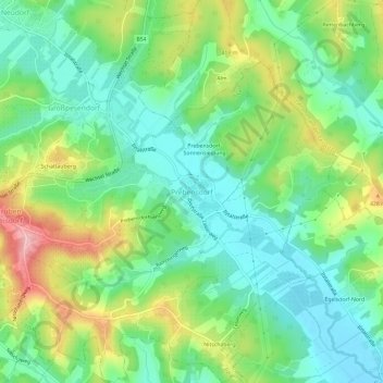
Name: Prebensdorf topographic map, elevation, terrain.
Location: Prebensdorf, Ilztal, Bezirk Weiz, Steiermark, 8211, Österreich (47.12218 15.76225 47.16218 15.80225)
Average elevation: 370 m
Minimum elevation: 318 m
Maximum elevation: 468 m