
Thank you for supporting this site ❤️
Make a donation
Make a donation
Kampung Ah Siang topographic map
Click on the map to display elevation.
Thank you for supporting this site ❤️
Make a donation
Make a donation
About this map
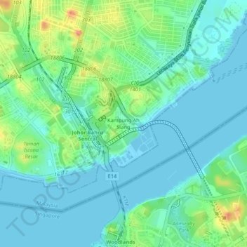
Name: Kampung Ah Siang topographic map, elevation, terrain.
Location: Kampung Ah Siang, Johor Bahru, Johor, 80730, Malaysia (1.44313 103.75043 1.48313 103.79043)
Average elevation: 15 m
Minimum elevation: -9 m
Maximum elevation: 60 m
Thank you for supporting this site ❤️
Make a donation
Make a donation
Other topographic maps
Click on a map to view its topography, its elevation and its terrain.
Pandan Lake Recreation Site
Malaysia > Johor > Johor Bahru > Kampung Seri Bahagia
Average elevation: 11 m
Thank you for supporting this site ❤️
Make a donation
Make a donation
Thank you for supporting this site ❤️
Make a donation
Make a donation