
Thank you for supporting this site ❤️
Make a donation
Make a donation
Hattingen topographic map
Click on the map to display elevation.
Thank you for supporting this site ❤️
Make a donation
Make a donation
About this map
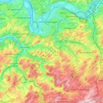
Name: Hattingen topographic map, elevation, terrain.
Location: Hattingen, Ennepe-Ruhr-Kreis, Noordrijn-Westfalen, Duitsland (51.30994 7.10806 51.42529 7.25716)
Average elevation: 168 m
Minimum elevation: 53 m
Maximum elevation: 324 m
Thank you for supporting this site ❤️
Make a donation
Make a donation
Other topographic maps
Click on a map to view its topography, its elevation and its terrain.