
Thank you for supporting this site ❤️
Make a donation
Make a donation
Bear Mountain topographic map
Click on the map to display elevation.
Thank you for supporting this site ❤️
Make a donation
Make a donation
About this map
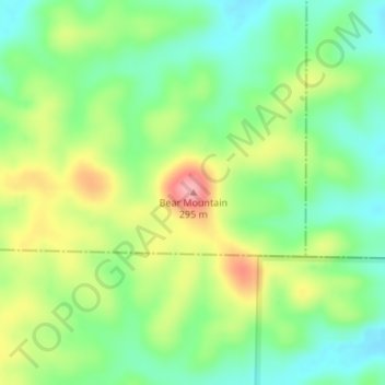
Name: Bear Mountain topographic map, elevation, terrain.
Location: Bear Mountain, Reynolds County, Missouri, United States (37.05472 -90.78962 37.05482 -90.78952)
Average elevation: 221 m
Minimum elevation: 176 m
Maximum elevation: 290 m
Thank you for supporting this site ❤️
Make a donation
Make a donation
Other topographic maps
Click on a map to view its topography, its elevation and its terrain.
Current River Conservation Area
United States > Missouri > Reynolds County > Ellington
Average elevation: 250 m