
Thank you for supporting this site ❤️
Make a donation
Make a donation
Burlington topographic map
Click on the map to display elevation.
Thank you for supporting this site ❤️
Make a donation
Make a donation
About this map
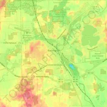
Name: Burlington topographic map, elevation, terrain.
Location: Burlington, Racine County, Wisconsin, 53105, United States (42.63920 -88.31840 42.71249 -88.22604)
Average elevation: 239 m
Minimum elevation: 195 m
Maximum elevation: 278 m
Thank you for supporting this site ❤️
Make a donation
Make a donation
Other topographic maps
Click on a map to view its topography, its elevation and its terrain.