
Беломестное topographic map
Interactive map
Click on the map to display elevation.
About this map
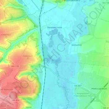
Name: Беломестное topographic map, elevation, terrain.
Average elevation: 144 m
Minimum elevation: 113 m
Maximum elevation: 222 m
Other topographic maps
Click on a map to view its topography, its elevation and its terrain.
Belgorod
Russie > Oblast de Belgorod > Белгородский район
Belgorod, Белгородский район, Oblast de Belgorod, District fédéral central, Russie
Average elevation: 163 m