
Thank you for supporting this site ❤️
Make a donation
Make a donation
Lesterville topographic map
Click on the map to display elevation.
Thank you for supporting this site ❤️
Make a donation
Make a donation
About this map
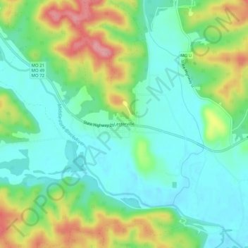
Name: Lesterville topographic map, elevation, terrain.
Location: Lesterville, Reynolds County, Missouri, 63654, United States (37.43394 -90.86346 37.47394 -90.82346)
Average elevation: 231 m
Minimum elevation: 193 m
Maximum elevation: 308 m
Thank you for supporting this site ❤️
Make a donation
Make a donation
Other topographic maps
Click on a map to view its topography, its elevation and its terrain.