

Make a donation
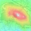
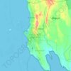
Musoma topographic map
Click on the map to display elevation.
Make a donation
About this map

Name: Musoma topographic map, elevation, terrain.
Location: Musoma, Musoma Municipal, Lake Zone, 31100, Tanzania (-1.65982 33.64830 -1.33982 33.96830)
Average elevation: 1,180 m
Minimum elevation: 1,130 m
Maximum elevation: 1,425 m
Make a donation
Other topographic maps
Click on a map to view its topography, its elevation and its terrain.
Morogoro Region
The Morogoro region has a total size of 73,039 square kilometers, which is split between land (70,967 square kilometers, or 97.2 percent of the total area), and water (2,073 km2 or 2.8 percent). As of 2012, Ulanga District is the largest district,Malinyi DC comes in second with 17.0 percent of the region's…
Average elevation: 539 m

Kilimanjaro
Mount Kilimanjaro (/ˌkɪlɪmənˈdʒɑːroʊ/) is a dormant volcano in Tanzania. It is the highest mountain in Africa and the highest free-standing mountain above sea level in the world: 5,895 m (19,341 ft) above sea level and 4,900 m (16,100 ft) above its plateau base. It is also the highest volcano in the…
Average elevation: 1,537 m
Dodoma
The official capital since 1996, Dodoma was envisaged as the first non-monumental capital city as opposed to the monumentality and hierarchy of other planned capital cities such as Abuja, Yamoussoukro, Brasília and Washington, D.C. It rejected geometrical forms such as grid iron and radial plans as…
Average elevation: 1,143 m
Make a donation


Iringa Region
The elevation of Iringa varies from 900 to 2,300 meters above sea level. A significant scarp that can reach 800 meters in height and is the eastern portion of the Great Rift Valley surrounds the area on all sides. Iringa is hence situated in Tanzania's southern highlands, bordering Mbeya, Njombe, Morogoro,…
Average elevation: 1,106 m

Dodoma
The official capital since 1996, Dodoma was envisaged as the first non-monumental capital city as opposed to the monumentality and hierarchy of other planned capital cities such as Abuja, Yamoussoukro, Brasília and Washington, D.C. It rejected geometrical forms such as grid iron and radial plans as…
Average elevation: 1,143 m
Make a donation
Dodoma
The official capital since 1996, Dodoma was envisaged as the first non-monumental capital city as opposed to the monumentality and hierarchy of other planned capital cities such as Abuja, Yamoussoukro, Brasília and Washington, D.C. It rejected geometrical forms such as grid iron and radial plans as…
Average elevation: 1,143 m


Make a donation

Make a donation
Kilimanjaro
Kilimanjaro is the fourth most topographically prominent peak on Earth. It is part of Kilimanjaro National Park and is a major hiking and climbing destination. Because of its shrinking glaciers and ice fields, which are projected to disappear between 2025 and 2035, it has been the subject of many scientific…
Average elevation: 1,537 m
Kilimanjaro
Mount Kilimanjaro (/ˌkɪlɪmənˈdʒɑːroʊ/) is a dormant volcano in Tanzania. It is the highest mountain in Africa and the highest free-standing mountain above sea level in the world: 5,895 m (19,341 ft) above sea level and 4,900 m (16,100 ft) above its plateau base. It is also the highest volcano in the…
Average elevation: 1,537 m
Mbeya Region
The Great Rift Valley created the majority of the places in the area, with the lowland elevation occupying the Western Rift Zone, which includes the Lake Rukwa and Lake Nyasa regions, and the Eastern Rift Zone, which includes the Usangu Plains and other sections of the Ruaha Trough. The heights range from 475…
Average elevation: 1,314 m

Make a donation
Morogoro Region
The Morogoro region has a total size of 73,039 square kilometers, which is split between land (70,967 square kilometers, or 97.2 percent of the total area), and water (2,073 km2 or 2.8 percent). As of 2012, Ulanga District is the largest district,Malinyi DC comes in second with 17.0 percent of the region's…
Average elevation: 539 m

Make a donation

Mbeya Region
The Great Rift Valley created the majority of the places in the area, with the lowland elevation occupying the Western Rift Zone, which includes the Lake Rukwa and Lake Nyasa regions, and the Eastern Rift Zone, which includes the Usangu Plains and other sections of the Ruaha Trough. The heights range from 475…
Average elevation: 1,314 m

Make a donation
Iringa Region
The elevation of Iringa varies from 900 to 2,300 meters above sea level. A significant scarp that can reach 800 meters in height and is the eastern portion of the Great Rift Valley surrounds the area on all sides. Iringa is hence situated in Tanzania's southern highlands, bordering the Mbeya, Njombe, Morogoro,…
Average elevation: 1,106 m

Ruvuma Region
Ruvuma Region is located in the Southern Highlands, which range between 300 and 2000 meters above sea level. Lake Nyasa, which is located in the Western arm of the Great Rift Valley, covers the western portion of the area. The Matengo Mountains ranges, which reach heights of up to 2000 meters, are to the east…
Average elevation: 829 m


Pangani
Formerly the main course towards the sea was alternatively called "Ruvu" and "Pangani". Nowadays that has been settled as "Pangani" from the Nyumba ya Mungu reservoir to the Ocean. While the Swahili call it "Pangani" (meaning distribute or arrange), it is called "Luffu" by the Wasambara (indigenous to the…
Average elevation: 767 m
Make a donation

Katavi Region
At an altitude of 1,000 to 2,500 meters above sea level, the Katavi Region has typical yearly temperatures between 26 and 30 degrees Celsius. The range of the average annual rainfall is 920 to 1,200 mm. The district is made up of gentle plains, plateaus, tiny mountain peaks, moderate hills, and Mwese…
Average elevation: 1,128 m
Mbeya Region
The Great Rift Valley created the majority of the places in the area, with the lowland elevation occupying the Western Rift Zone, which includes the Lake Rukwa and Lake Nyasa regions, and the Eastern Rift Zone, which includes the Usangu Plains and other sections of the Ruaha Trough. The heights range from 475…
Average elevation: 1,314 m
Katavi Region
At an altitude of 1,000 to 2,500 meters above sea level, the Katavi Region has typical yearly temperatures between 26 and 30 degrees celsius. The range of the average annual rainfall is 920 to 1,200 mm. The district is made up of gentle plains, plateaus, tiny mountain peaks, moderate hills, and Mwese…
Average elevation: 1,128 m
Dodoma
The official capital since 1996, Dodoma was envisaged as the first non-monumental capital city as opposed to the monumentality and hierarchy of other planned capital cities such as Abuja, Yamoussoukro, Brasília and Washington, D.C. It rejected geometrical forms such as grid iron and radial plans as…
Average elevation: 1,143 m
Make a donation
Katavi Region
At an altitude of 1,000 to 2,500 meters above sea level, the Katavi Region has typical yearly temperatures between 26 and 30 degrees celsius. The range of the average annual rainfall is 920 to 1,200 mm. The district is made up of gentle plains, plateaus, tiny mountain peaks, moderate hills, and Mwese…
Average elevation: 1,128 m
Kigoma Region
Kigoma Region is on a plateau that slopes from the northeast at about 1,750 metres (5,740 ft) down to 800 metres (2,600 ft) at the shore of lake Tanganyika. The topography in the north and east is gently rolling hills that gradually become steeper as they get closer to the Albertine Rift margin. The most…
Average elevation: 1,215 m
Kilimanjaro
Mount Kilimanjaro (/ˌkɪlɪmənˈdʒɑːroʊ/) is a dormant volcano in Tanzania. It is the highest mountain in Africa and the highest free-standing mountain above sea level in the world, situated at 5,895 m (19,341 ft) above sea level and 4,900 m (16,100 ft) above its plateau base. It is also the highest…
Average elevation: 1,537 m

Make a donation


Njombe Region
The Njombe Region, which is a part of Tanzania's Southern Highlands zone, has extensive rainy seasons and brief dry seasons, which are typically cool with moderate winds. The yearly total rainfall varies greatly geographically, seasonally, and annually, ranging from 600mm to 1,600mm. A single, very distinct…
Average elevation: 1,317 m

Dodoma Region
Due to irregular and low rainfall, the Dodoma region is primarily semi-arid. Rainfall in the region usually falls between November/December and April/May in a single rainy season. Often, storms bring strong rains that cause flash floods. The annual total precipitation ranges from 500 to 800 mm. Although the…
Average elevation: 1,159 m
Make a donation

Mbeya Region
The Great Rift Valley created the majority of the places in the area, with the lowland elevation occupying the Western Rift Zone, which includes the Lake Rukwa and Lake Nyasa regions, and the Eastern Rift Zone, which includes the Usangu Plains and other sections of the Ruaha Trough. The heights range from 475…
Average elevation: 1,314 m
Make a donation

Monduli
A number of isolated mountains (Monduli, Lepurko, Loosimingori, and Lengai) and broad rolling plains characterize the land landscape. The heights range from 600m in the low elevations to 2900m in the high elevations. The District's vegetation includes a combination of forest, bushland, woodland grassland, and…
Average elevation: 1,369 m


Make a donation


Make a donation
Shinyanga Region
Four distinct agro-ecological zones are established within the Shinyanga Region mostly based on topographical factors and local meteorological conditions. Parts of Kishapu District and a few wards in Shinyanga District Council are included in the eastern zone. Sandalized soils and thick clay soils are features…
Average elevation: 1,202 m

Mtwara Region
Mtwara is both the most eastern and southern region in the country. The region is located between 10 and 11 degrees south of the Equator. Mtwara is the third smallest region after Dar es Salaam Region and Kilimanjaro Region at 16,710 km2 (6,450 sq mi). An area occupying 1.9% of the country. In comparison…
Average elevation: 298 m
Njombe Region
The Njombe Region, which is a part of Tanzania's Southern Highlands zone, has extensive rainy seasons and brief dry seasons, which are typically cool with moderate winds. The yearly total rainfall varies greatly geographically, seasonally, and annually, ranging from 600mm to 1,600mm. A single, very distinct…
Average elevation: 1,317 m
Make a donation
Lake Rukwa
The alkaline Lake Rukwa lies midway between Lake Tanganyika and Lake Malawi at an elevation of about 800 metres (2,600 ft), in a parallel branch of the rift system. Almost half of the lake lies in Uwanda Game Reserve.
Average elevation: 1,189 m

Make a donation


Tanga Region
Tanga Region is the 15th largest region by size with an area of 26,667 km2 (10,296 sq mi), after Songwe Region at 27,656 km2 (10,678 sq mi). An area occupying 3% of the country. In comparison, Tanga is larger than the African nation of Burundi at 25,680 square kilometers. The Tanga Region shares land borders…
Average elevation: 576 m
Make a donation


Mara River
The altitudes in the basin range from 2,932 m around the sources in the Mau Escarpment to 1,134 m around Lake Victoria. The amount of precipitation varies according to these altitudes. The Mau Escarpment receives most rainfall with a mean annual rainfall between 1,000 and 1,750 mm. The transboundary middle…
Average elevation: 1,555 m
Make a donation


Make a donation


Make a donation


Make a donation


Make a donation
Shinyanga Region
Four distinct agro-ecological zones are established within the Shinyanga Region mostly based on topographical factors and local meteorological conditions. Parts of Kishapu District and a few wards in Shinyanga District Council are included in the eastern zone. Sandalized soils and thick clay soils are features…
Average elevation: 1,202 m


Iringa Region
The elevation of Iringa varies from 900 to 2,300 meters above sea level. A significant scarp that can reach 800 meters in height and is the eastern portion of the Great Rift Valley surrounds the area on all sides. Iringa is hence situated in Tanzania's southern highlands, bordering Mbeya, Njombe, Morogoro,…
Average elevation: 1,106 m
Make a donation

Singida Region
The temperatures in the region vary according to altitude but generally range from about 15 °C in July to 30 °C during the month of October. Moreover, temperature differences are observed between day and night and may be very high, with hot afternoons going up to 35 °C and chilly nights going down to 10 °C.
Average elevation: 1,221 m
Mtwara Region
Mtwara is both the most eastern and southern region in the country. The region is located between 10 and 11 degrees south of the Equator. Mtwara is the third smallest region after Dar es Salaam Region and Kilimanjaro Region at 16,710 km2 (6,450 sq mi). An area occupying 1.9% of the country. In comparison…
Average elevation: 298 m
Make a donation



Make a donation