
Thank you for supporting this site ❤️
Make a donation
Make a donation
Binéfar topographic map
Click on the map to display elevation.
Thank you for supporting this site ❤️
Make a donation
Make a donation
About this map
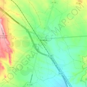
Name: Binéfar topographic map, elevation, terrain.
Location: Binéfar, La Litera, Huesca, Aragón, 22500, España (41.81833 0.25125 41.87435 0.33975)
Average elevation: 301 m
Minimum elevation: 240 m
Maximum elevation: 423 m
Thank you for supporting this site ❤️
Make a donation
Make a donation
Other topographic maps
Click on a map to view its topography, its elevation and its terrain.