
Thank you for supporting this site ❤️
Make a donation
Make a donation
San Luis topographic map
Click on the map to display elevation.
Thank you for supporting this site ❤️
Make a donation
Make a donation
About this map
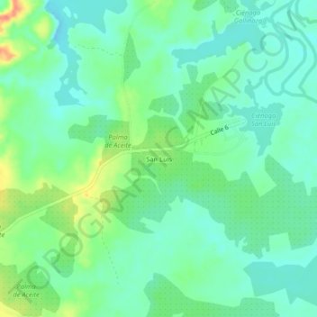
Name: San Luis topographic map, elevation, terrain.
Location: San Luis, Simití, Bolívar, Colombia (7.80979 -73.92836 7.84979 -73.88836)
Average elevation: 54 m
Minimum elevation: 37 m
Maximum elevation: 90 m
Thank you for supporting this site ❤️
Make a donation
Make a donation
Other topographic maps
Click on a map to view its topography, its elevation and its terrain.