
Bazargan topographic map
Interactive map
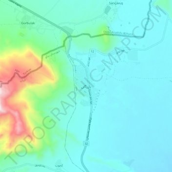
Click on the map to display elevation.
About this map
Name: Bazargan topographic map, elevation, terrain.
Average elevation: 1,507 m
Minimum elevation: 1,366 m
Maximum elevation: 2,189 m
Until well within the 20th century, Bazargan was not much more than a small village, located at an altitude of 1,550 meters on a delta above the Aqchay river. Bazargan's inhabitants, of Turkic origin, were generally involved in traditional agricultural activities. In 1913, the village was ceded by the Ottoman Empire to Qajar Iran. The village of Bazargan has only developed recently (and that in a limited way), due to the existence of the nearby frontier crossing with Turkey.[4]
Other topographic maps
Click on a map to view its topography, its elevation and its terrain.
Malham
Iran > West Azerbaijan Province > Maku County
Malham, بخش بازرگان, Maku County, West Azerbaijan Province, Iran
Average elevation: 1,277 m