
Ottenberg topographic map
Interactive map
Click on the map to display elevation.
About this map
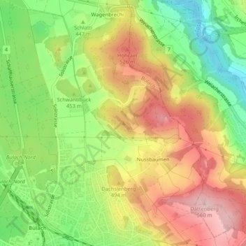
Name: Ottenberg topographic map, elevation, terrain.
Location: Ottenberg, Bülach, Bezirk Bülach, Zürich, 8180, Zwitserland (47.53444 8.55045 47.53454 8.55055)
Average elevation: 457 m
Minimum elevation: 349 m
Maximum elevation: 565 m