
Thank you for supporting this site ❤️
Make a donation
Make a donation
Peaston Bank topographic map
Click on the map to display elevation.
Thank you for supporting this site ❤️
Make a donation
Make a donation
About this map
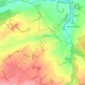
Name: Peaston Bank topographic map, elevation, terrain.
Location: Peaston Bank, East Lothian, Scotland, EH34 5ET, United Kingdom (55.86841 -2.91002 55.90841 -2.87002)
Average elevation: 128 m
Minimum elevation: 72 m
Maximum elevation: 185 m
Thank you for supporting this site ❤️
Make a donation
Make a donation
Other topographic maps
Click on a map to view its topography, its elevation and its terrain.