
Thank you for supporting this site ❤️
Make a donation
Make a donation
Runaruna topographic map
Click on the map to display elevation.
Thank you for supporting this site ❤️
Make a donation
Make a donation
About this map
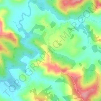
Name: Runaruna topographic map, elevation, terrain.
Average elevation: 81 m
Minimum elevation: 36 m
Maximum elevation: 165 m
Thank you for supporting this site ❤️
Make a donation
Make a donation
Other topographic maps
Click on a map to view its topography, its elevation and its terrain.
Utakura River
New Zealand > Northland > Far North District > Kaikohe-Hokianga Community
Average elevation: 124 m