
Thank you for supporting this site ❤️
Make a donation
Make a donation
Lengdorf topographic map
Click on the map to display elevation.
Thank you for supporting this site ❤️
Make a donation
Make a donation
About this map
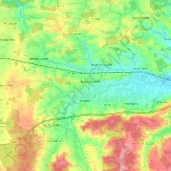
Name: Lengdorf topographic map, elevation, terrain.
Location: Lengdorf, Landkreis Erding, Beieren, 84435, Duitsland (48.22241 12.00454 48.29919 12.09908)
Average elevation: 500 m
Minimum elevation: 447 m
Maximum elevation: 568 m
Thank you for supporting this site ❤️
Make a donation
Make a donation
Other topographic maps
Click on a map to view its topography, its elevation and its terrain.