
Swanage topographic map
Click on the map to display elevation.
About this map
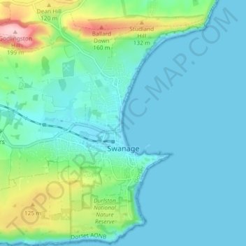
Name: Swanage topographic map, elevation, terrain.
Location: Swanage, Dorset, England, United Kingdom (50.59040 -1.99323 50.63629 -1.94277)
Average elevation: 38 m
Minimum elevation: 0 m
Maximum elevation: 200 m
Other topographic maps
Click on a map to view its topography, its elevation and its terrain.