
Thank you for supporting this site ❤️
Make a donation
Make a donation
Melgar topographic map
Click on the map to display elevation.
Thank you for supporting this site ❤️
Make a donation
Make a donation
About this map
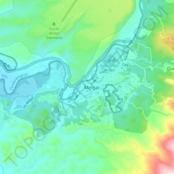
Name: Melgar topographic map, elevation, terrain.
Location: Melgar, Tolima, 734001, Colombia (4.16405 -74.68516 4.24405 -74.60516)
Average elevation: 403 m
Minimum elevation: 282 m
Maximum elevation: 830 m
Thank you for supporting this site ❤️
Make a donation
Make a donation