
Thank you for supporting this site ❤️
Make a donation
Make a donation
Penobscot River topographic map
Click on the map to display elevation.
Thank you for supporting this site ❤️
Make a donation
Make a donation
About this map
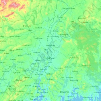
Name: Penobscot River topographic map, elevation, terrain.
Location: Penobscot River, Penobscot County, Maine, 04489, USA (44.43550 -68.84754 45.60408 -68.35897)
Average elevation: 120 m
Minimum elevation: -3 m
Maximum elevation: 1,088 m
Thank you for supporting this site ❤️
Make a donation
Make a donation
Other topographic maps
Click on a map to view its topography, its elevation and its terrain.