
Thank you for supporting this site ❤️
Make a donation
Make a donation
Malga Ciapela topographic map
Click on the map to display elevation.
Thank you for supporting this site ❤️
Make a donation
Make a donation
About this map
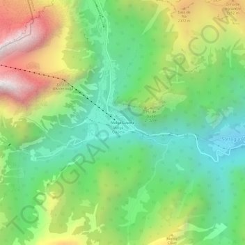
Name: Malga Ciapela topographic map, elevation, terrain.
Location: Malga Ciapela, Rocca Pietore, Belluno, Veneto, 32020, Italy (46.40767 11.89179 46.44767 11.93179)
Average elevation: 1,866 m
Minimum elevation: 1,247 m
Maximum elevation: 2,927 m
Thank you for supporting this site ❤️
Make a donation
Make a donation