
Thank you for supporting this site ❤️
Make a donation
Make a donation
Changunarayan topographic map
Click on the map to display elevation.
Thank you for supporting this site ❤️
Make a donation
Make a donation
About this map
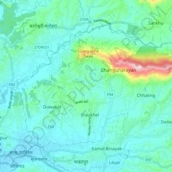
Name: Changunarayan topographic map, elevation, terrain.
Location: Changunarayan, Bhaktapur, Bagmati Pradesh, 97701, Nepal (27.67716 85.39622 27.72831 85.47702)
Average elevation: 1,360 m
Minimum elevation: 1,301 m
Maximum elevation: 1,653 m
Thank you for supporting this site ❤️
Make a donation
Make a donation