
Thank you for supporting this site ❤️
Make a donation
Make a donation
Pagaralam Ulubelu topographic map
Click on the map to display elevation.
Thank you for supporting this site ❤️
Make a donation
Make a donation
About this map
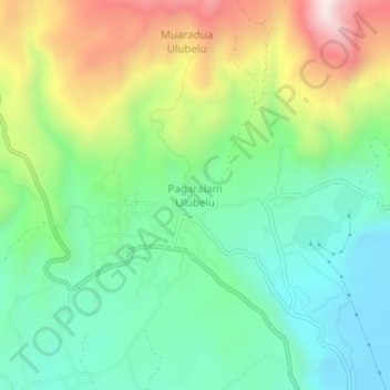
Name: Pagaralam Ulubelu topographic map, elevation, terrain.
Location: Pagaralam Ulubelu, Tanggamus, Lampung, Sumatra, Indonesia (-5.32522 104.54096 -5.28522 104.58096)
Average elevation: 939 m
Minimum elevation: 688 m
Maximum elevation: 1,415 m
Thank you for supporting this site ❤️
Make a donation
Make a donation
Other topographic maps
Click on a map to view its topography, its elevation and its terrain.