
Thank you for supporting this site ❤️
Make a donation
Make a donation
Ete Vivo topographic map
Click on the map to display elevation.
Thank you for supporting this site ❤️
Make a donation
Make a donation
About this map
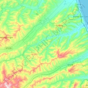
Name: Ete Vivo topographic map, elevation, terrain.
Location: Ete Vivo, Fermo, Marche, Italia (43.06862 13.51897 43.16309 13.81156)
Average elevation: 167 m
Minimum elevation: -2 m
Maximum elevation: 569 m
Thank you for supporting this site ❤️
Make a donation
Make a donation
Other topographic maps
Click on a map to view its topography, its elevation and its terrain.