
Thank you for supporting this site ❤️
Make a donation
Make a donation
Carriazo topographic map
Click on the map to display elevation.
Thank you for supporting this site ❤️
Make a donation
Make a donation
About this map
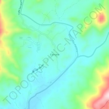
Name: Carriazo topographic map, elevation, terrain.
Location: Carriazo, San Martín, Distrito Panamá, Panamá (9.18529 -79.26232 9.22529 -79.22232)
Average elevation: 137 m
Minimum elevation: 64 m
Maximum elevation: 370 m
Thank you for supporting this site ❤️
Make a donation
Make a donation