
Komako topographic map
Interactive map
Click on the map to display elevation.
About this map
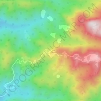
Name: Komako topographic map, elevation, terrain.
Location: Komako, Bakou, Haut-Nkam, Région de l'Ouest, Cameroun (5.02340 10.12051 5.06340 10.16051)
Average elevation: 934 m
Minimum elevation: 622 m
Maximum elevation: 1,391 m