
Thank you for supporting this site ❤️
Make a donation
Make a donation
Il Roc topographic map
Click on the map to display elevation.
Thank you for supporting this site ❤️
Make a donation
Make a donation
About this map
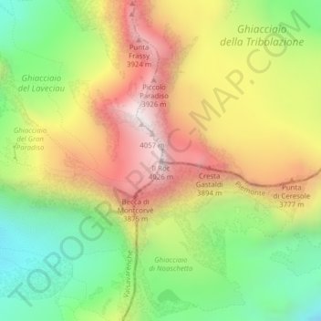
Name: Il Roc topographic map, elevation, terrain.
Location: Il Roc, Valsavarenche, Valle d'Aosta, Italia (45.51467 7.26946 45.51477 7.26956)
Average elevation: 3,456 m
Minimum elevation: 2,951 m
Maximum elevation: 4,019 m
Thank you for supporting this site ❤️
Make a donation
Make a donation
Other topographic maps
Click on a map to view its topography, its elevation and its terrain.